
Jerry Jenkins, 11 October 016
I am just back from two weeks in eastern Maine and Nova Scotia, photographing shores and thinking about how they work. Shoreline processes are a big subject, and it will be a while before I am ready to write about them in any detail. In the meantime, here are some of the places I looked at and some ideas from my notes.
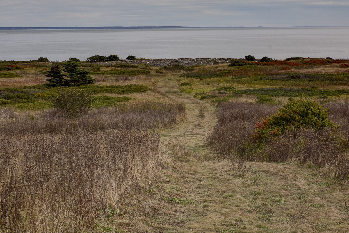
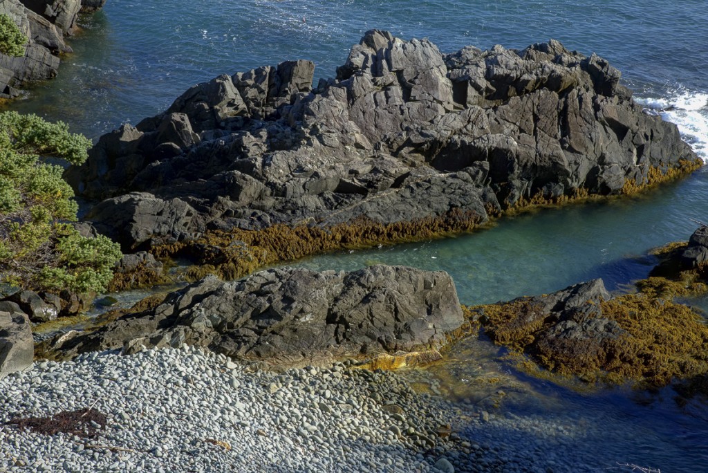
Dyer Point, in eastern Maine, is a classic rocky spit. Here is the west shore, with gently sloping benches of Devonian granite with vertical joints.
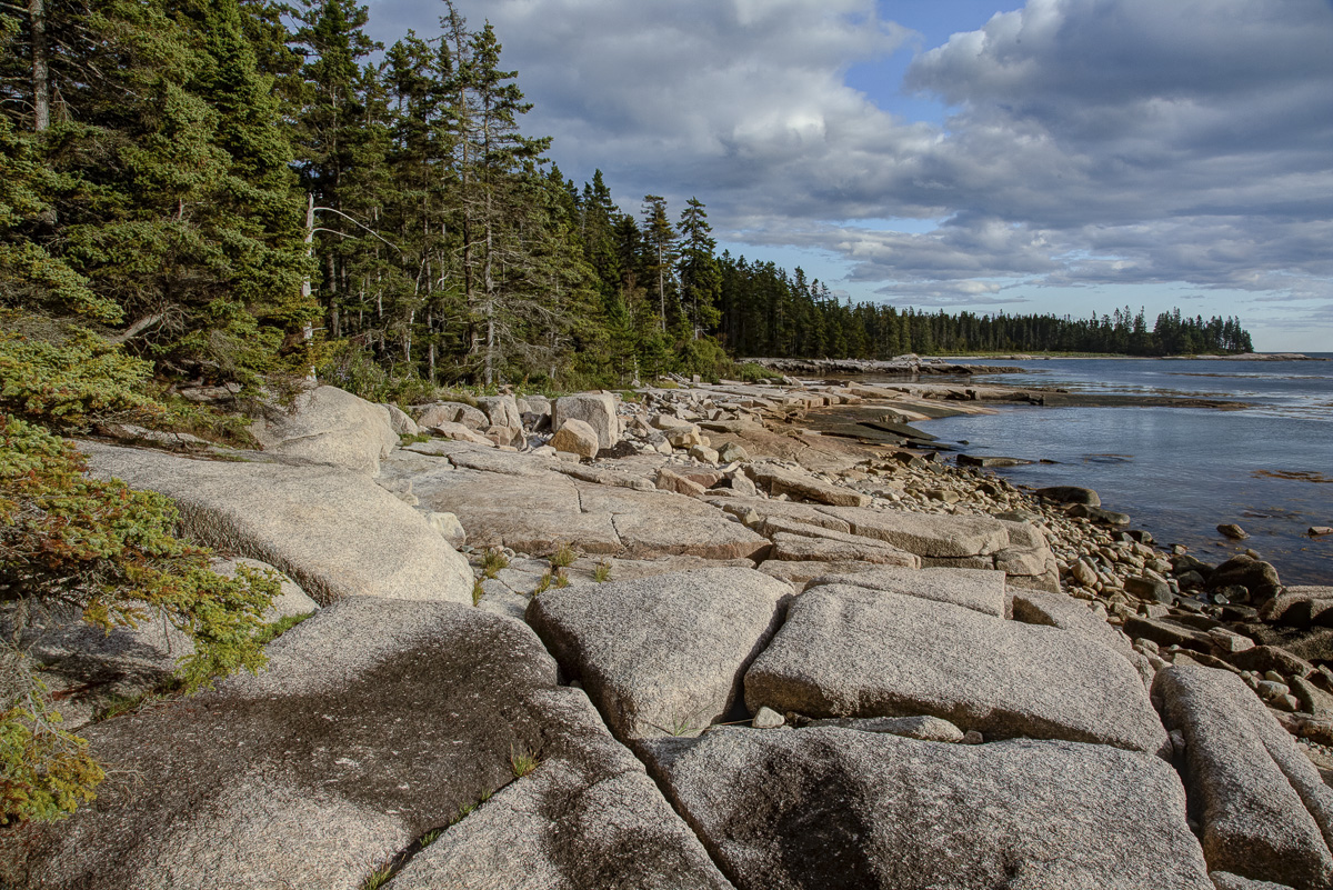
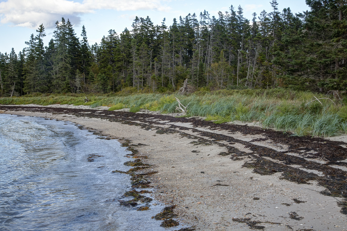
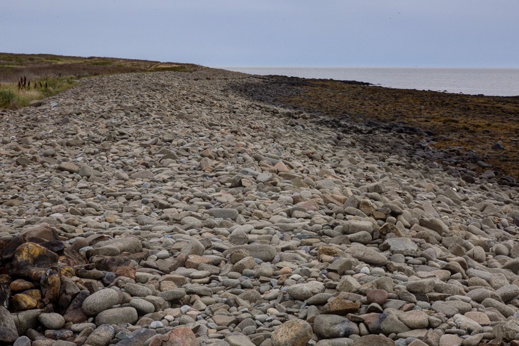
The shore is a series of coves and points. The points are bedrock, but the coves have walls (“berms”) of loose round stones.
Or, in places, sand and gravel. So the wave energy seems to vary with topography, greatest on the points, and least in the coves. The points are eroding, or at least scouring, environments. The coves are depositing ones. Notice how the beach grass here comes right down to the tide line, and there is no eroding bank at the edge of the forest.
This suggests something interesting. If the coves are depositing environments, they were not shaped by the sea. The cove must be a terrestrial land form that has been submerged rather than the result of marine erosion.
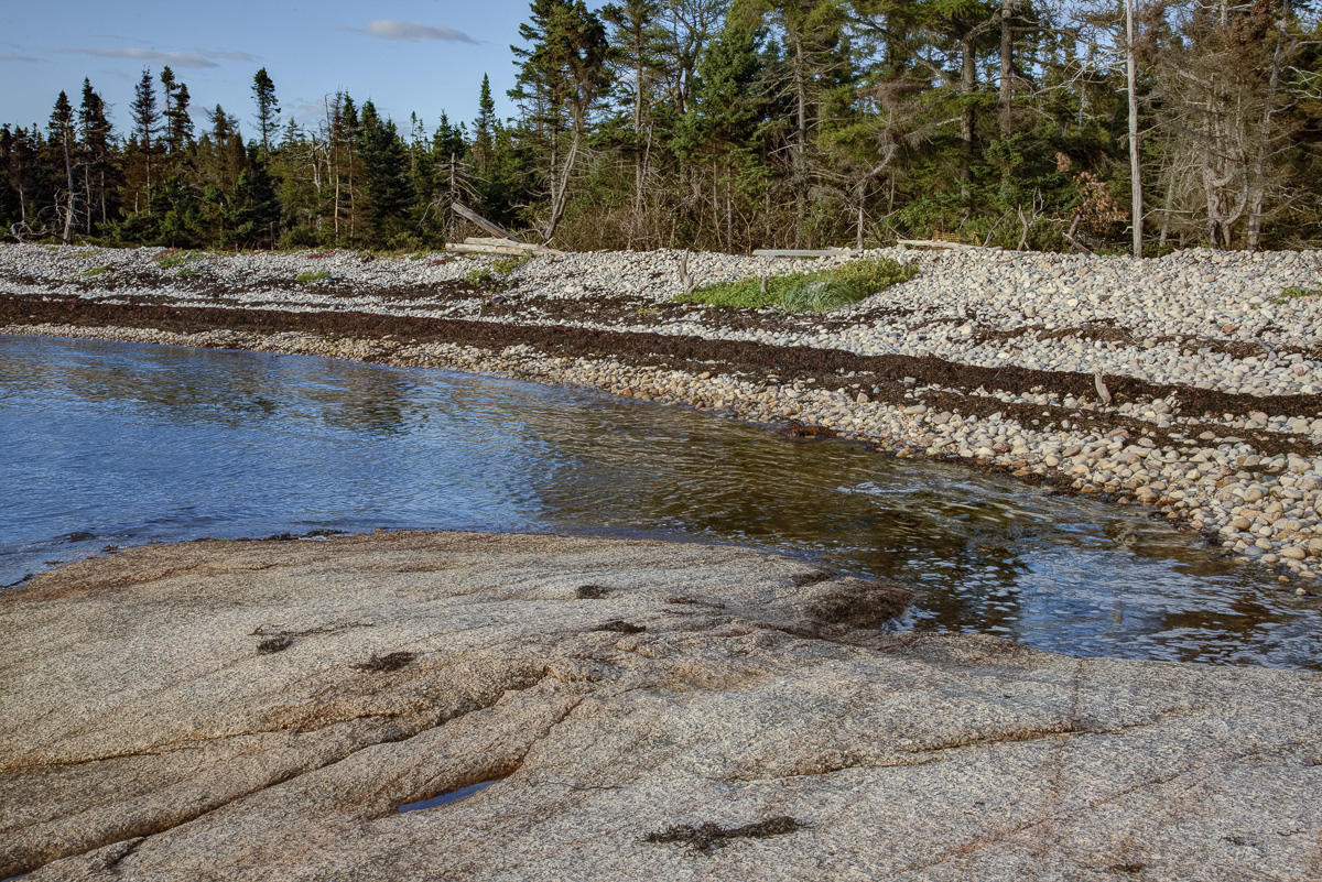
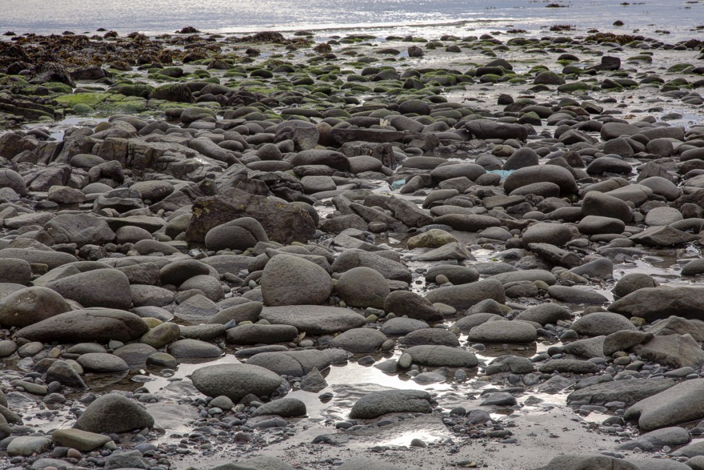
Here’s the back of a cove on Dyer. Perennial plants come right down to the edge, and there is no obvious sign of erosion. Sea-level rise will certainly push the cobble beach farther inland, but short of that it may be fairly stable.
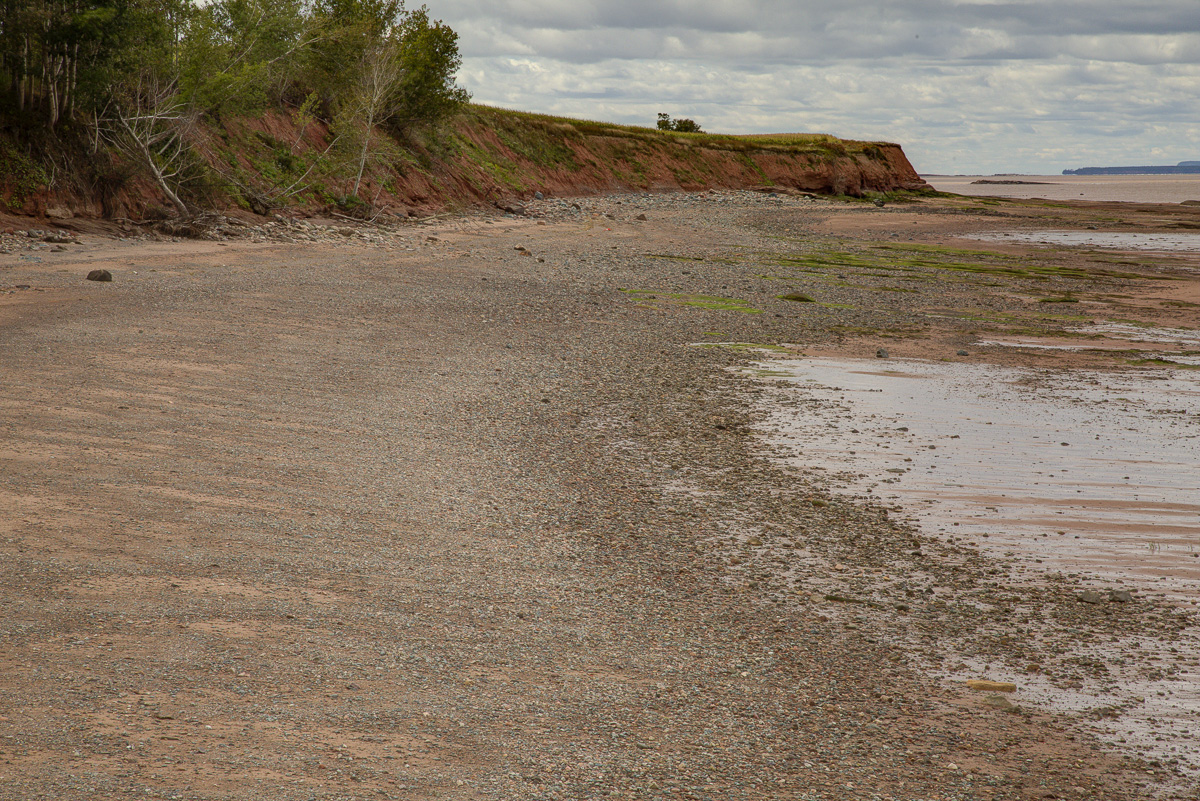
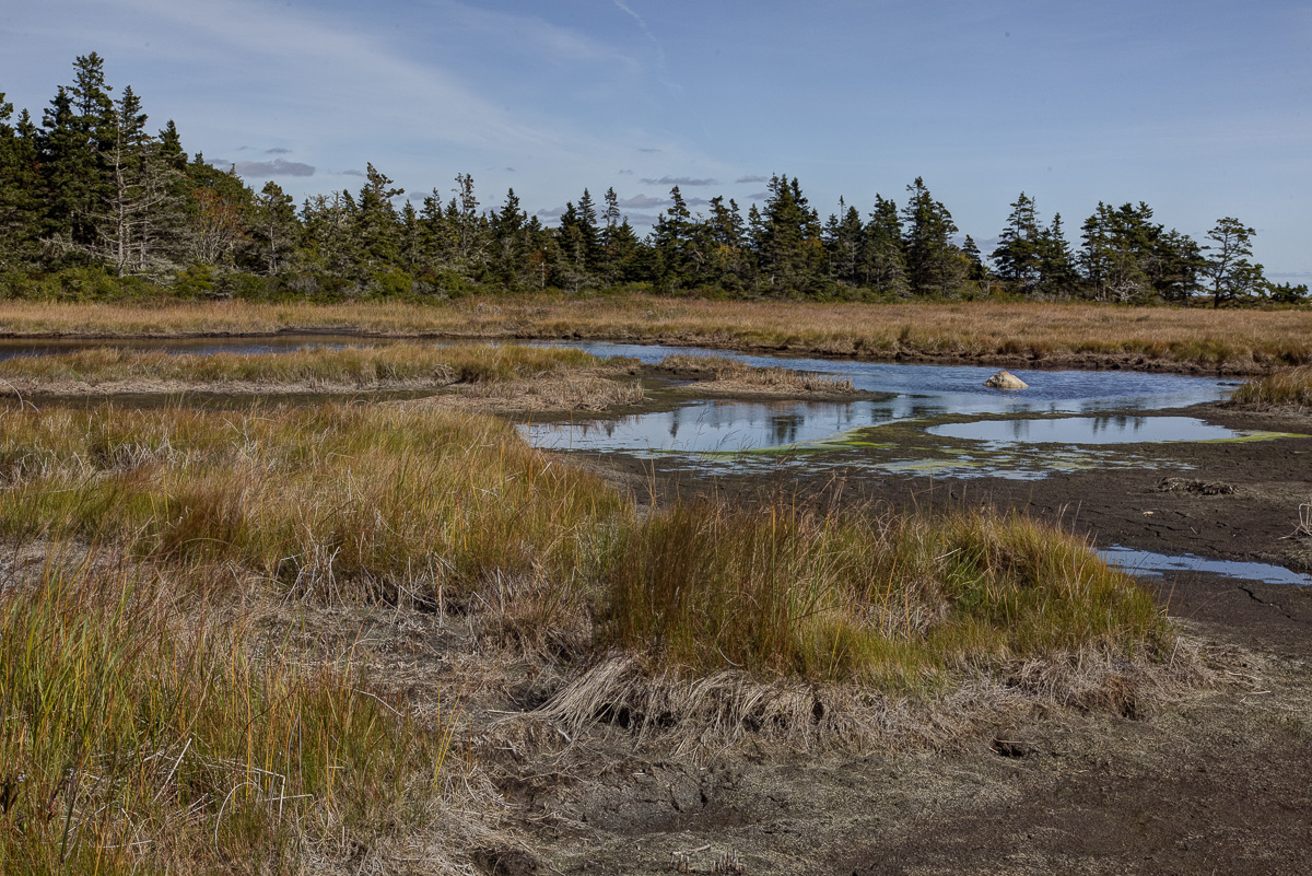
Dyer point, however, has good hard granite and lots of stones. Here a very different shore, Anthony Provincial Park, N.S. It is on Minas Basin, the southern arm of Bay of Fundy. A flat, soft-bottomed bay, big tides and strong tidal currents, waters filled with sediment.
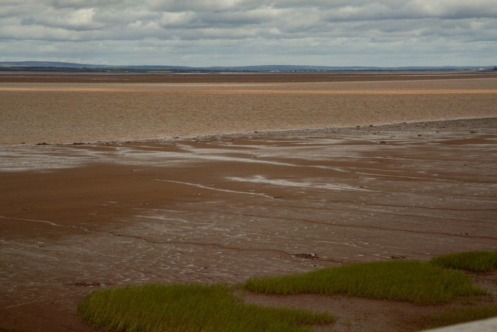
Handsome bands of saltmarsh, but only at the upper edge of the tide.
Eroding bluffs of soft Triassic mudstone, undercut at their bases by waves and tide, and receding from gully erosion above.
This is clearly an actively eroding shore, even though it is a much more protected one than Dyer. The green is a marine alga and the poor aspen is partly submerged at high tide.
Interestingly, the erosion only occurs at the very top of the tide, when the waves reach the base of the bluffs. The eroded material accumulates in the intertidal zone creating a broad flat beach. When the waves break on this beach they move mud and pebbles around, but don’t erode anything.
I thought about this shore for quite a while. My notes say Soft rocks that can be undercut can be eroded by waves. Especially if they crumble to fine material and there are currents to move the fines and smooth them out. Beaches are energy dumps, and wave energy only crosses them at high tide. Maybe only at exceptionally high tides. And while undercutting by waves triggers the erosion of the bluffs, it is ordinary gully erosion that removes most of the material.
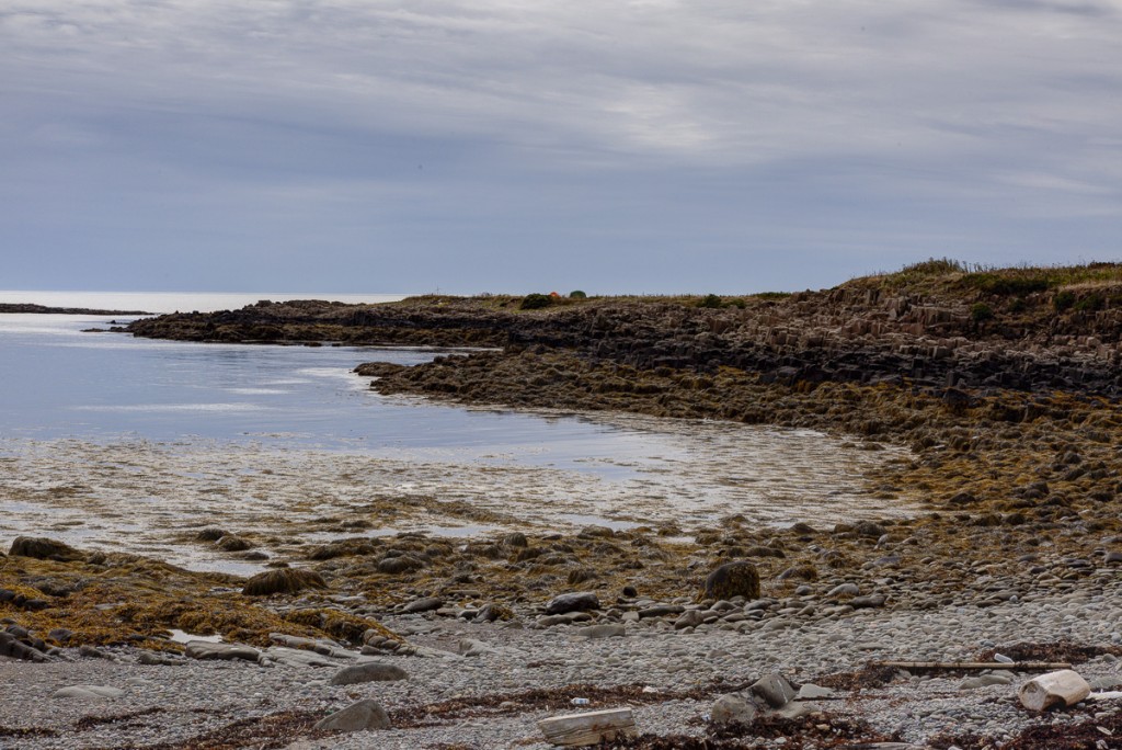
A few days later, my friend Roy Mandell—painter, farmer, father, fisherman, boat-builder—took me to the Deveau shore, in western Nova Scotia. The rocks here are metasediments from the Ordovician, some of the oldest in Nova Scotia.
We sat on a slope and watched the tide go out. Below us was a small cove bounded by rocks. The wave crests became curved (“defracted”) when they past though the rocks and, because of the flat rocky bottom, broke some distance from shore.
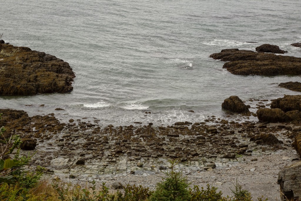
As the tide fell, we could see a sand and pebble beach, separated from the sea by a low wall or eroded rocks.
This got me thinking about an old geomorphological principle: erosion is self limiting unless renewed by uplift. Here, we should probably add or by sea-level rise. The weathered, seaweed-covered rocks disperse and dissipate wave energy. Sand builds up in the low-energy cove and limits the energy that reaches the shore.
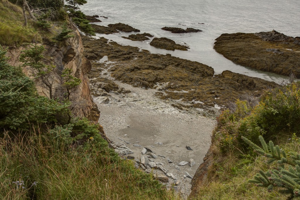
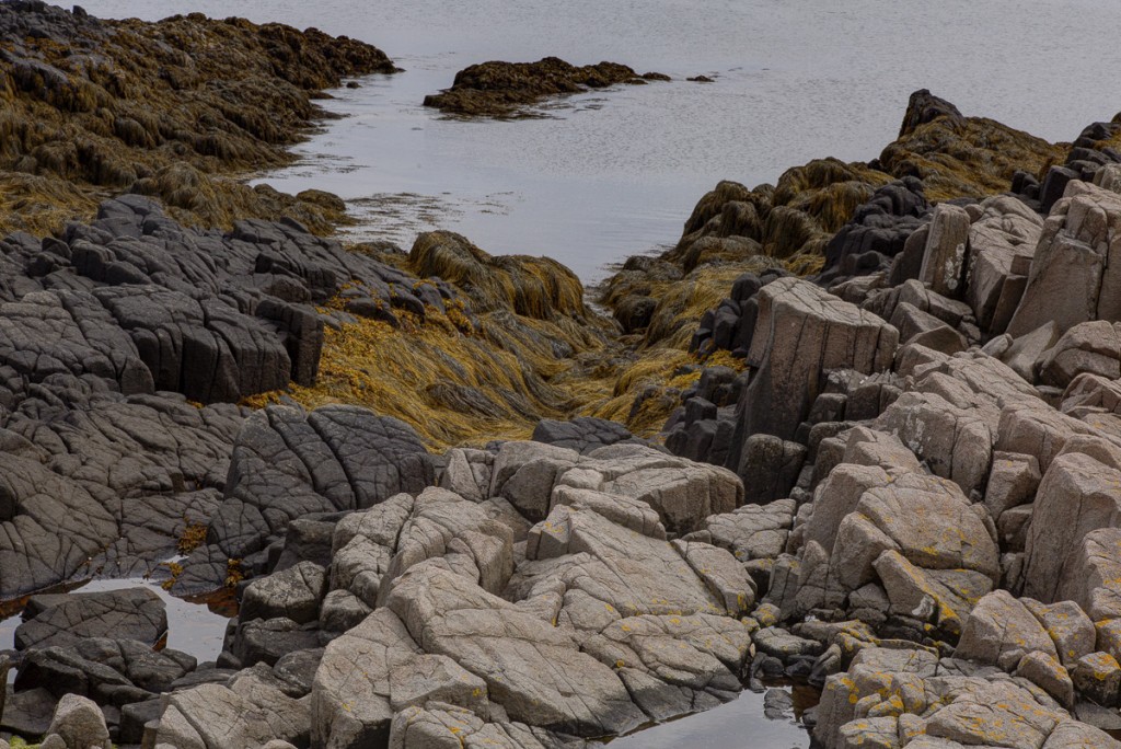
On either side of the cove were cliffs of an interesting, stripey rock that looked like gneiss. They were bare and much faulted. The bedding sloped outward, making it easy for blocks to come loose.
At the base were big blocks, apparently fallen from above, with their corners rounded by wave action. Whether or not waves had helped pluck the blocks from the cliff, they were clearly able to move them around the cliff base.
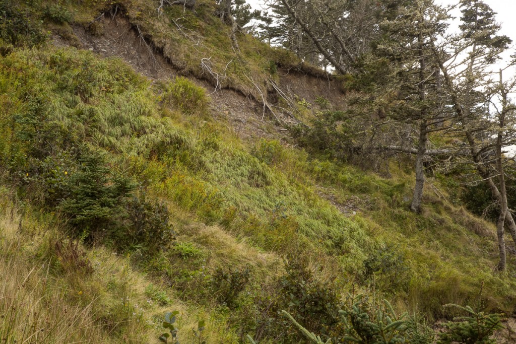
The tops of the cliffs were steep, wet, and crumbly. There were small streams, lots of loose rock, and indications of gullying and frost action.
The vegetation was an interesting wet peaty turf— a sort of hanging bog—of heaths, bayberry, spruce, herbs and grasses. It was doing its best to hold the ledge crests together, but was slipping downhill on the wet soils below.
Thinking about these cliffs, I realized how many different things were going on. The cliff tops were eroding from gullying and frost action, but being stabilized by vegetation. The tidal zone was eroding in places by wave action, but stabilized by debris and deposition in other places. The intertidal zone was apparently stable. So, unlike the Anthony cliffs that were eroding all over, the pattern here was complex: erosion in a few places, deposition in others. What mattered was the overall balance. This, I found out, was true for most of the cliffs I visited.
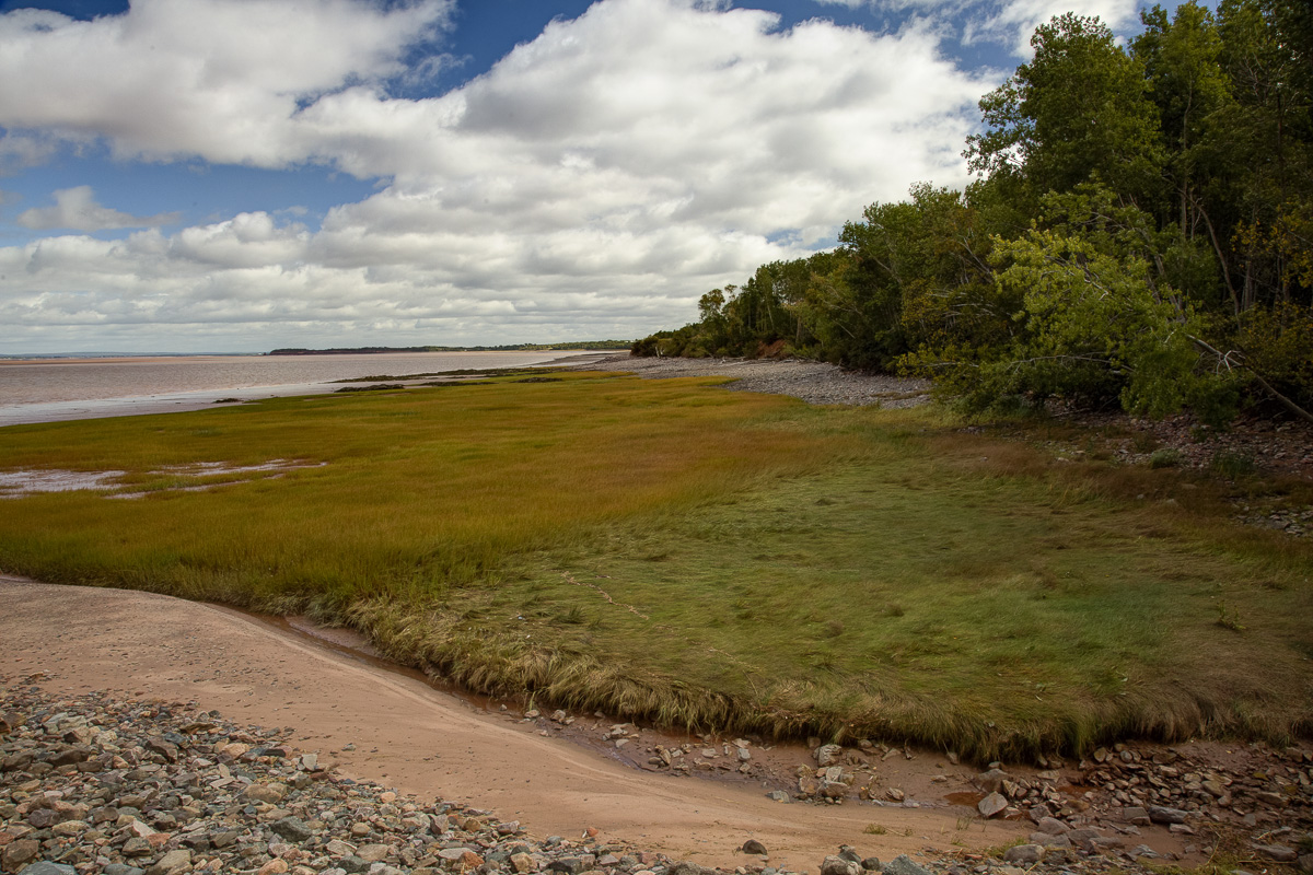
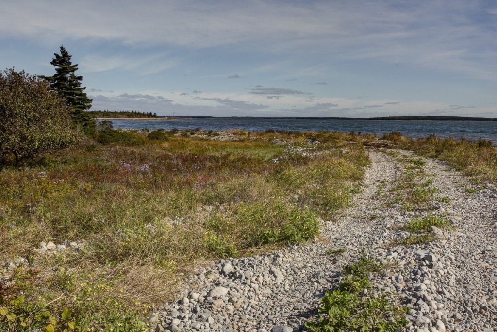
The next few days I was in Wedgeport, at the southwestern tip of Nova Scotia. The country is low and sandy, with wooded shores and low bluffs. The bedrock, like that at Deveau, is metasedimentary, but where I was I saw little bedrock at all.
Roy has a little ketch, the Mariasha, and we sailed around, looking at points, islands, and bars. The shores were mostly sandy, stony, or marshy. Only few places had cliffs or bluffs.

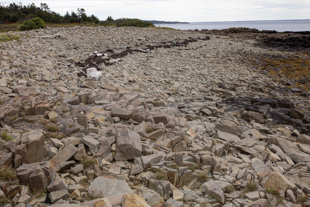
I spent an afternoon photographing at Wedge Point. Most of the shores had cobble beaches that rose to cobble or gravel berms, with forests or wetlands immediately behind the berm. This is the east side of the point, which is open to the Atlantic. The cobbles are here are big, loosely bedded, and mobile.

They are bare on their seaward faces, but vegetated, often weedily, on their crests and landward sides.
The intertidal zone is quite rocky, but there are also fine sediments—muds and peats—and bands of Spartina. The rocks are more firmly bedded and more vegetated. They don’t seem to roll much.

Behind the berm there are thickets of spruce, bayberry, and holly, and extensive saltmarshes and ponds.
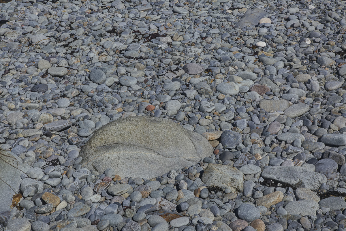
These cobble shores have intrigued me for some time. The height of the berms and the size of the rocks in them speak to the energy available. The continuity of the berms and the intactness of the vegetation behind them suggest that, like sand dunes, they are natural barriers that protect the shore from that energy. I call these armored shores and note that they are a bit of a surprise. Who would have thought that, given enough rocks and enough energy to move them around, a low shore could build itself a sea wall that limits further erosion?
This has lead me to an obvious question: Where do the stones come from? Or, put another way, if any shore can armor itself against erosion given enough waves and stones, is the reason that some shores are better armored simply that they have more stones?
For many years, my answer, would have been “No, not possible. Stones, like sand, are everywhere. They fall in the sea and get pushed around and come rolling up on any shore with enough wave energy to allow them to accumulate.” This sounds silly, now that I say it. Actually, except in crazy places like Fundy, tide and wave energy are mostly near the surface, and the sea bottom is probably an energy desert. When I looked at my pictures of cobble beaches, like this one from 2015 at Port Joli, I realized that the cobbles were almost all in the upper tidal zone, and in fact only in specific bands within it. Too much energy, as on the points, and they get swept away. Too little, as in the coves and the lower tidal, and they can’t move and likely get buried.

And so I have abandoned my idea of cohorts of gypsy rocks rolling across the sea bottom and lodging temporarily on cobble shores and replaced it with a different one. Perhaps most cobbles are stay-at-homes, generated by fracturing the local bedrock or eroding till, and confined to energy zones near where they were generated. They are mobile within these zones but largely confined to them, and unable to cross from one cobble bed to the next. I have no idea if this is true, and don’t in fact know whether anyone knows if it is true. But it has me thinking about how rocks move, and that is surprisingly interesting.
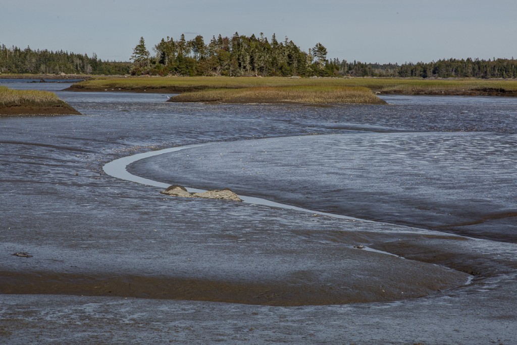
Leaving rocks for a moment. The salt marshes near the sea are mostly small. Much larger ones occur on protected shores near the heads of bays. Here are some from the northeast end of Surettes Island. They have broad channels and small rocky islands with spruce,
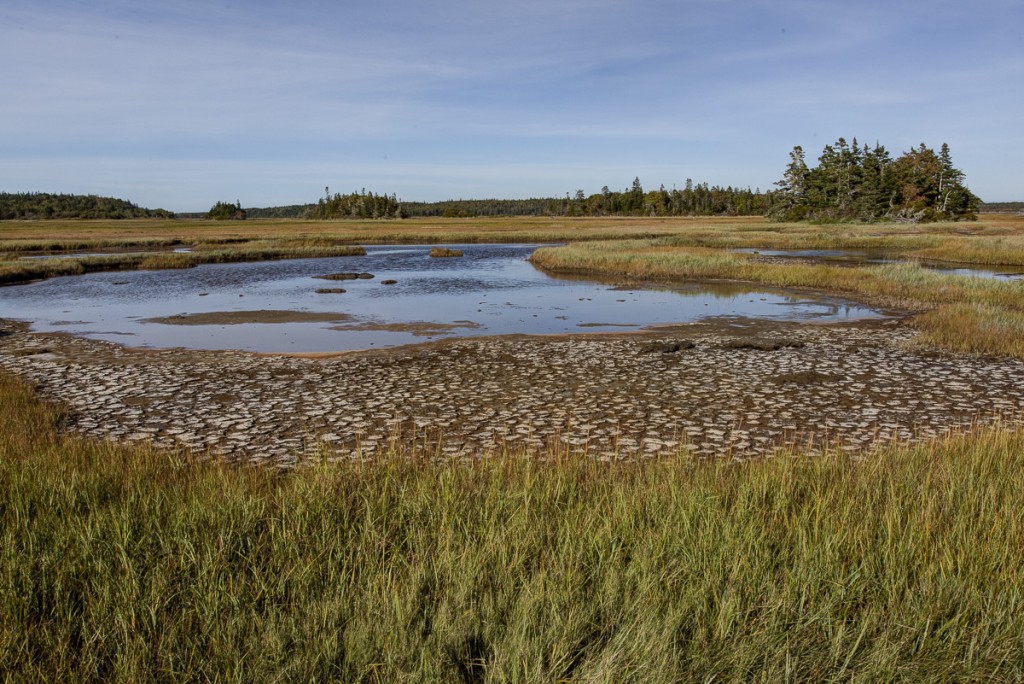
a network of salt ponds with marsh islands of their own,
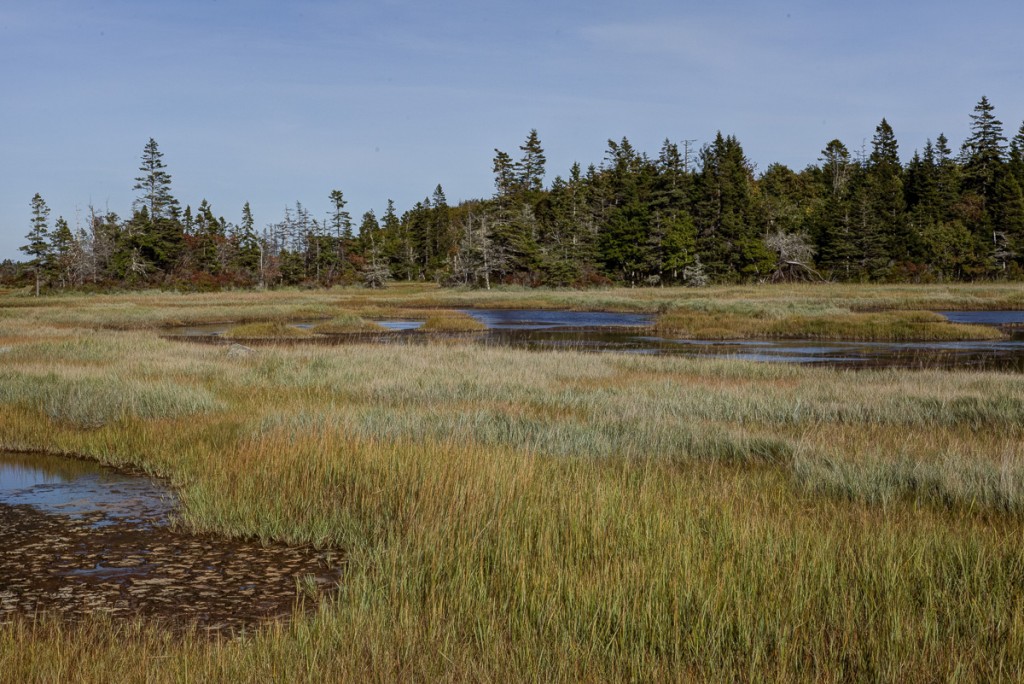
and broad mudflats whose low-water channels meander like alluvial rivers. They are quite beautiful, and different in complexity and scale from marshes I have seen elsewhere. They were a highpoint of the trip.
The last two saltwater stops on my trip were steep rocky shores. I wanted to look at more cliffs and cobble bars, test out the idea that cobbles come from local rocks, and see what kind of erosion was happening above the ciffs.
The first stop was Brier Island. It is the western tip of the North Mountain, a ridge of Jurassic basalt that parallels northwest coast of Nova Scotia. The southwest tip of Brier has big open meadows, probably once pastured, with many weeds.
The shore has rocky spits alternating with cobble shores and berms.
The basalt is columnar and breaks easily into chunks on vertical faults. The active breakup seems restricted to the top of the tide range.
The chunks are split into smaller pieces and then rounded by tumbling by the surf. No plants grow on the active face. Near the spits, the rocks are angular and almost all basalt.
Farther from the spits they are more rounded and mixed with what I assume are glacial cobbles from till. I see these mixed berms, like this one, as skeletal views, with the soil removed and all the rocks remaining.
The upper intertidal has a lot of loose stones, most of which look like basalt.
Thus Brier, from what I saw, seems to be a sort of factory turning basalt into cobbles. And the cobbles, again as best I could tell, are mostly made on Brier or eroded from local glacial till.
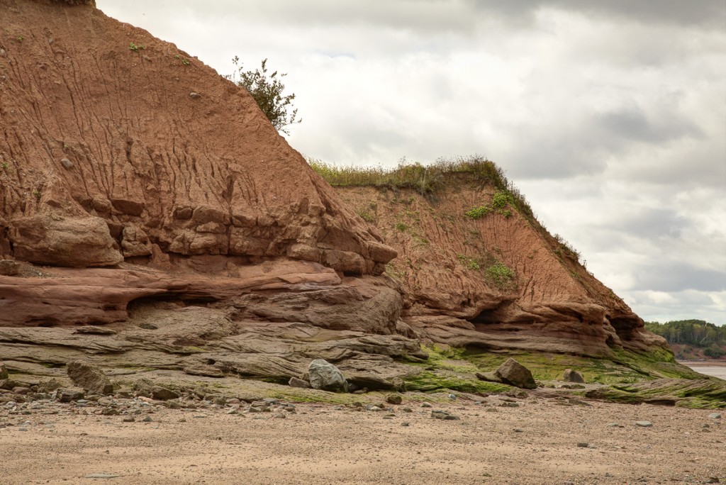
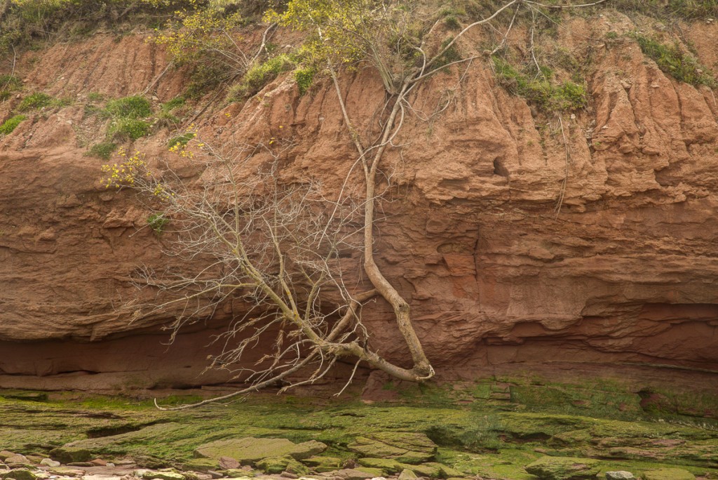
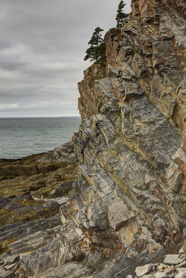
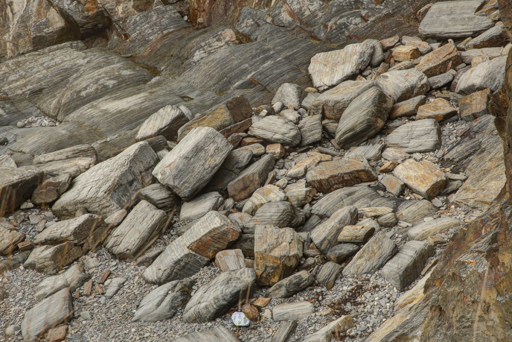
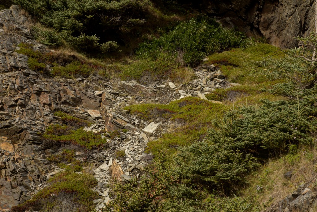
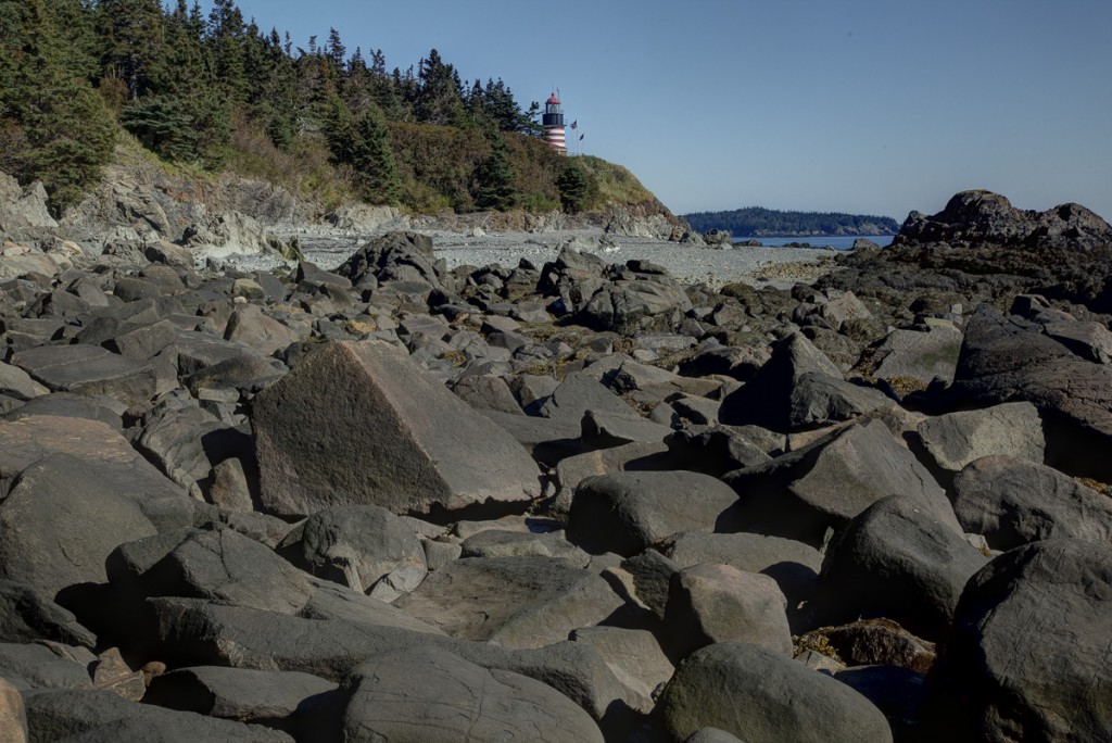
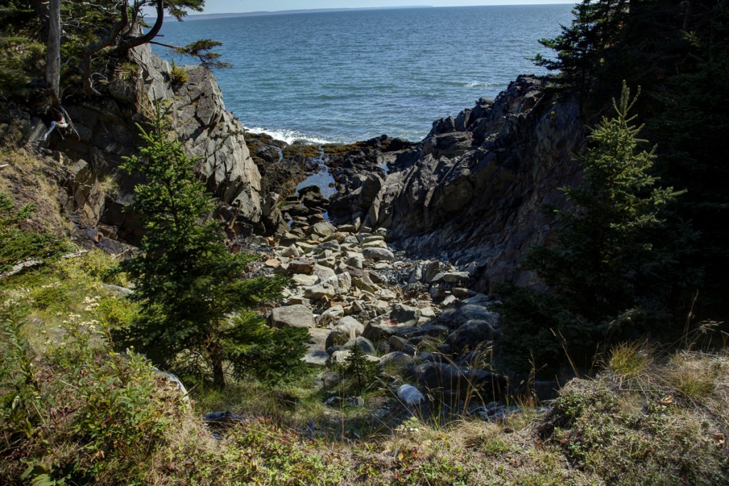
Much the same is true at Quoddy Head, the easternmost point in Maine. The rock here is a Silurian granite. It makes tall jagged cliffs that seem to be eroding both at the top and the bottom. Look how fractured the cliffs are, and how the vertical gullies seem to follow fault lines.

The shores often have piles of large angular blocks that have fallen from the cliffs.
In some places, where the shores are lower and sheltered by weathered rocks or debris, there are gravel beaches.
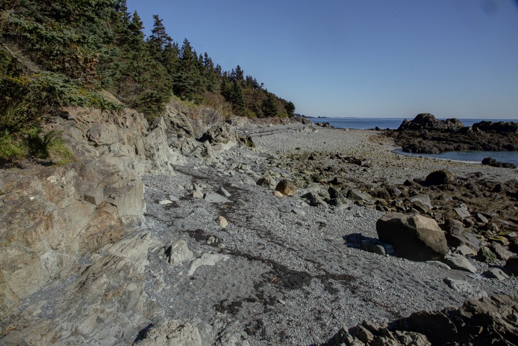
But more typically, there are steep cliffs bordering small coves with populations of large, mobile cobbles. I am assuming, as a working idea, that these cobbles are made by grinding down the rocks that fall in the coves and rarely if ever move from one cove to another.
The rocks in these coves are often surprisingly uniform, again suggesting they originate locally.
The coves are often the seaward ends of vertical gullies. The top ends of the gullies often have small streams and are actively eroding. The sea certainly is eroding the cliff bases. But the coves seem to be protected from the sea, and my suspicion is that many of the rocks in them originated from freshwater-driven gullying high up on the cliffs. If this is true, then the gullies are conveyor systems that move rock fragments from high on the cliffs down to the coves where they can be worked into cobbles.
Anyway. The northern coast is wonderful, and the story is not simply waves bashing rocks until they crack. There is terrestrial erosion too, and shielding and deposition, and energy gradients, and the mobility, or lack of mobility, of loose rocks. None of which I appreciated until I got there and started looking. And that, of course, is the fun of it.
Not many plants in this blog. They come next.
Jerry J., White Creek, NY.