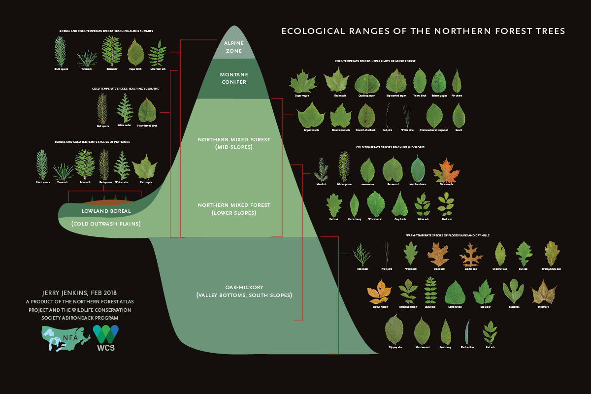
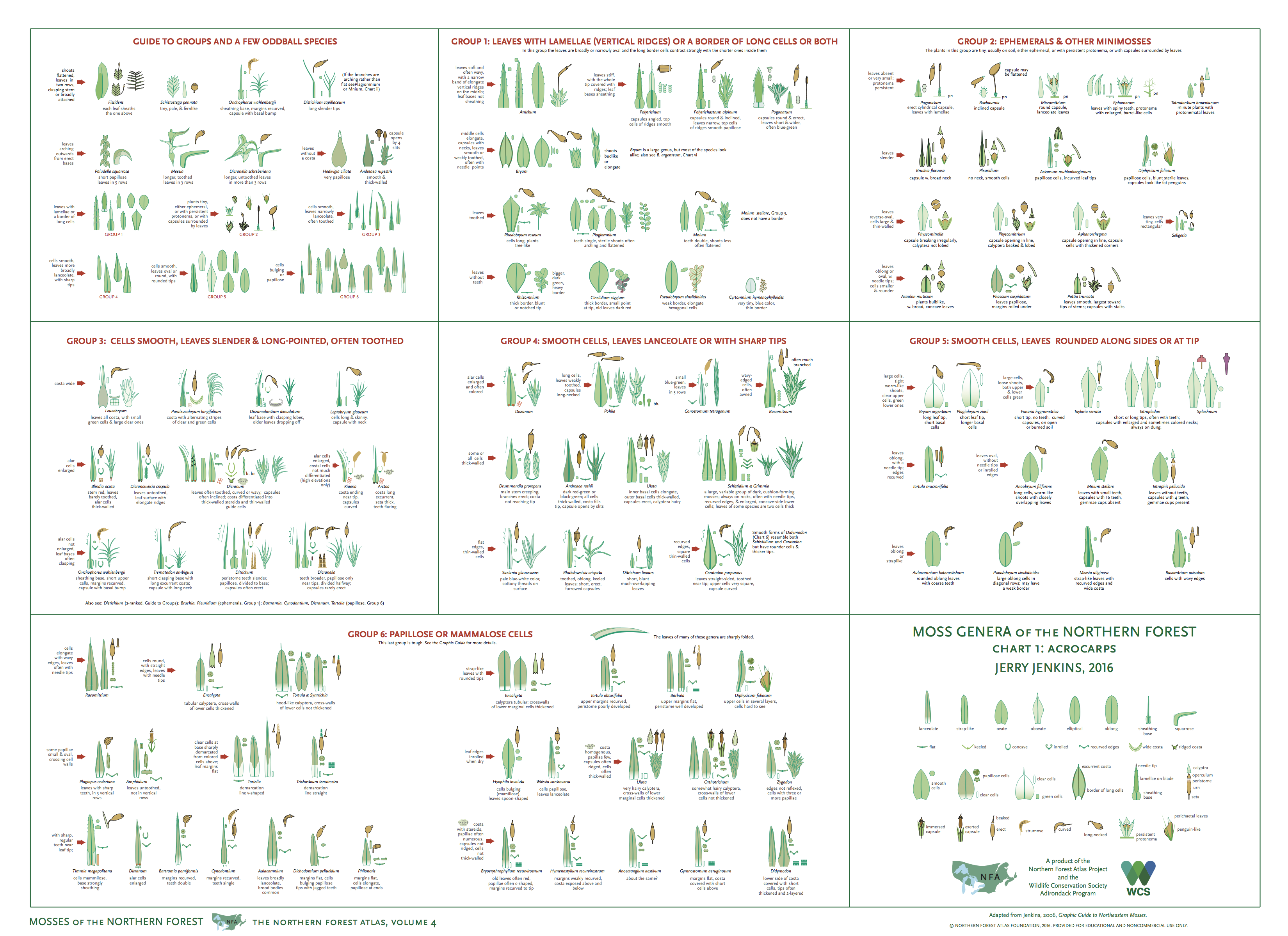
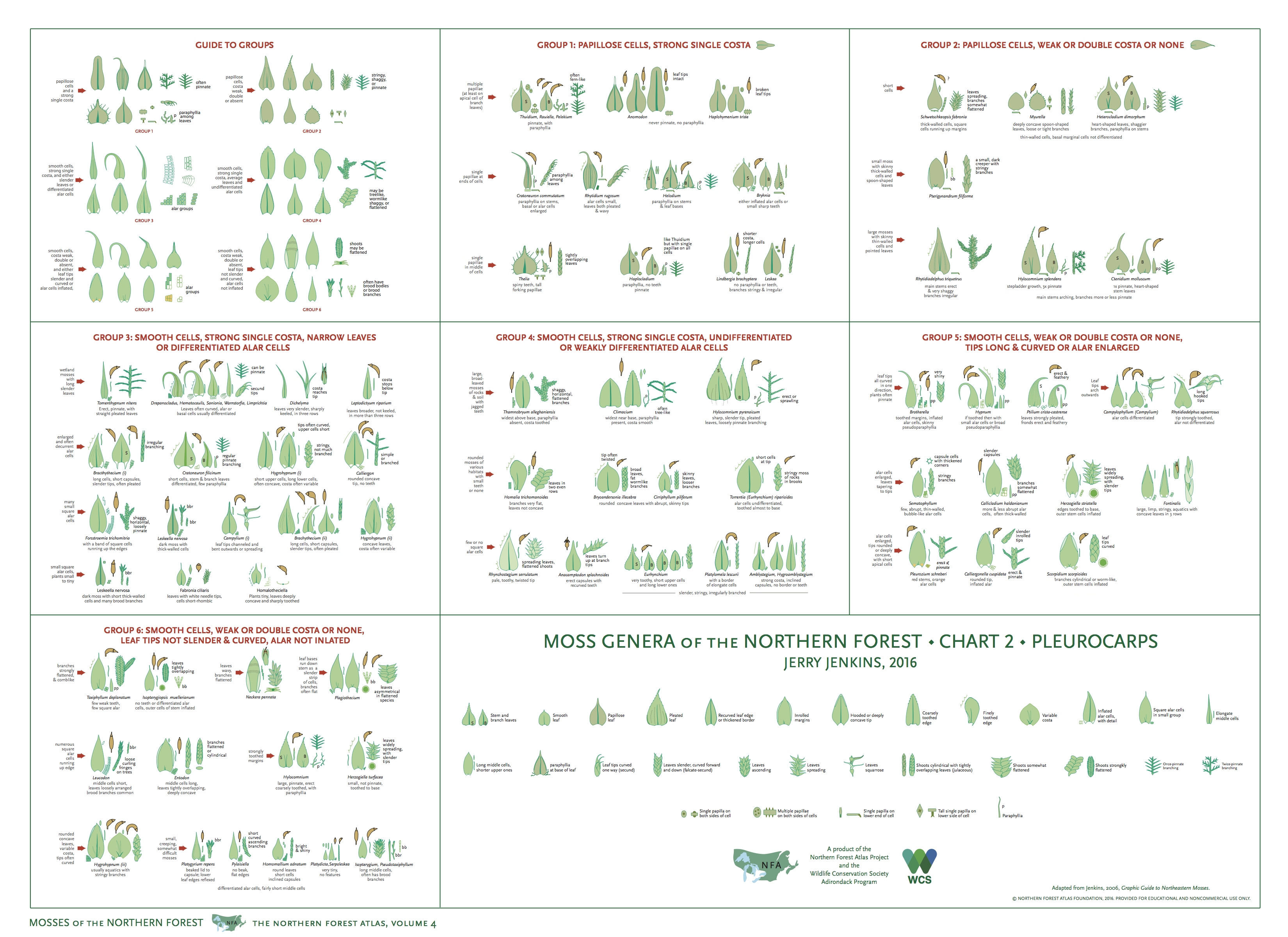
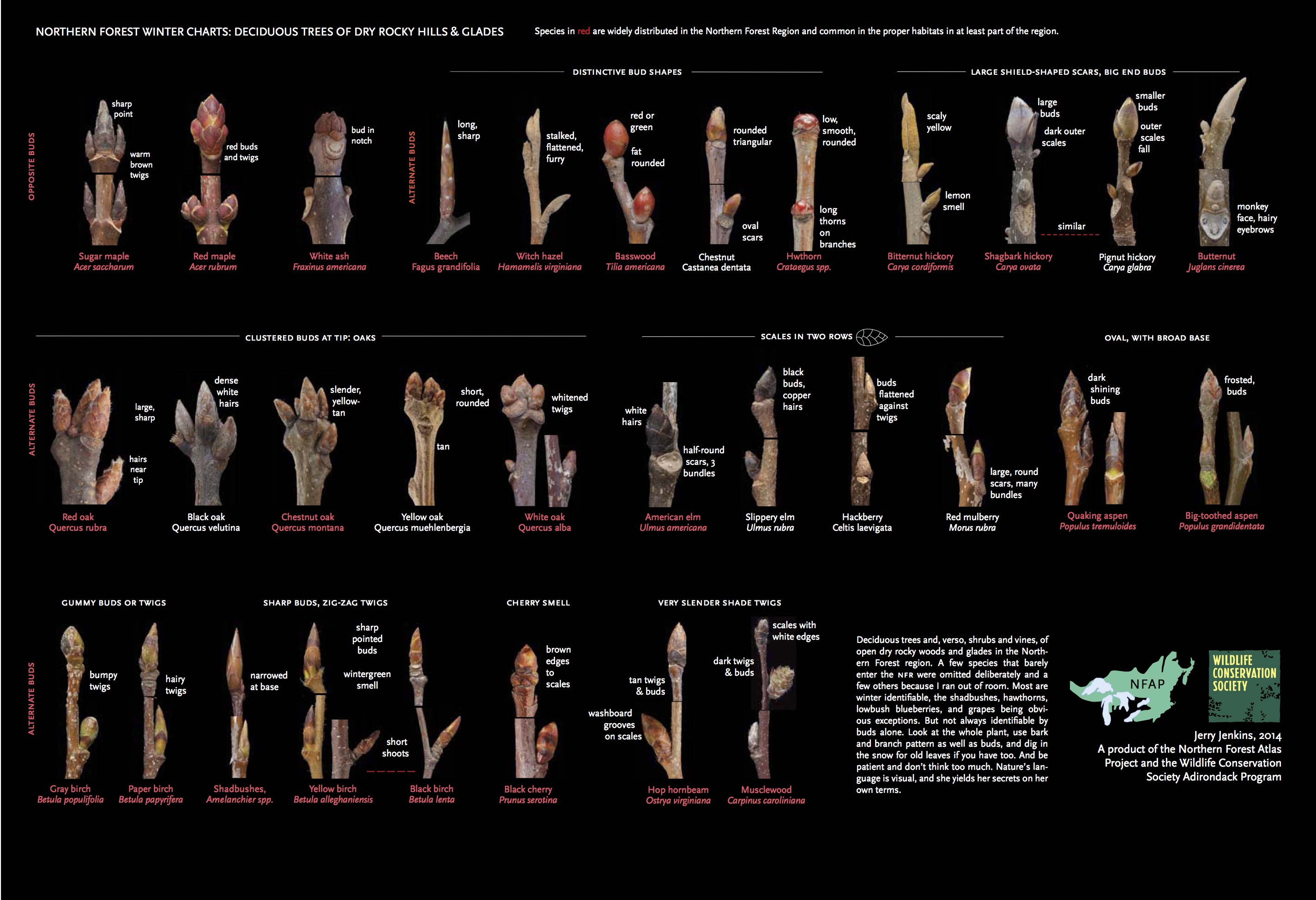
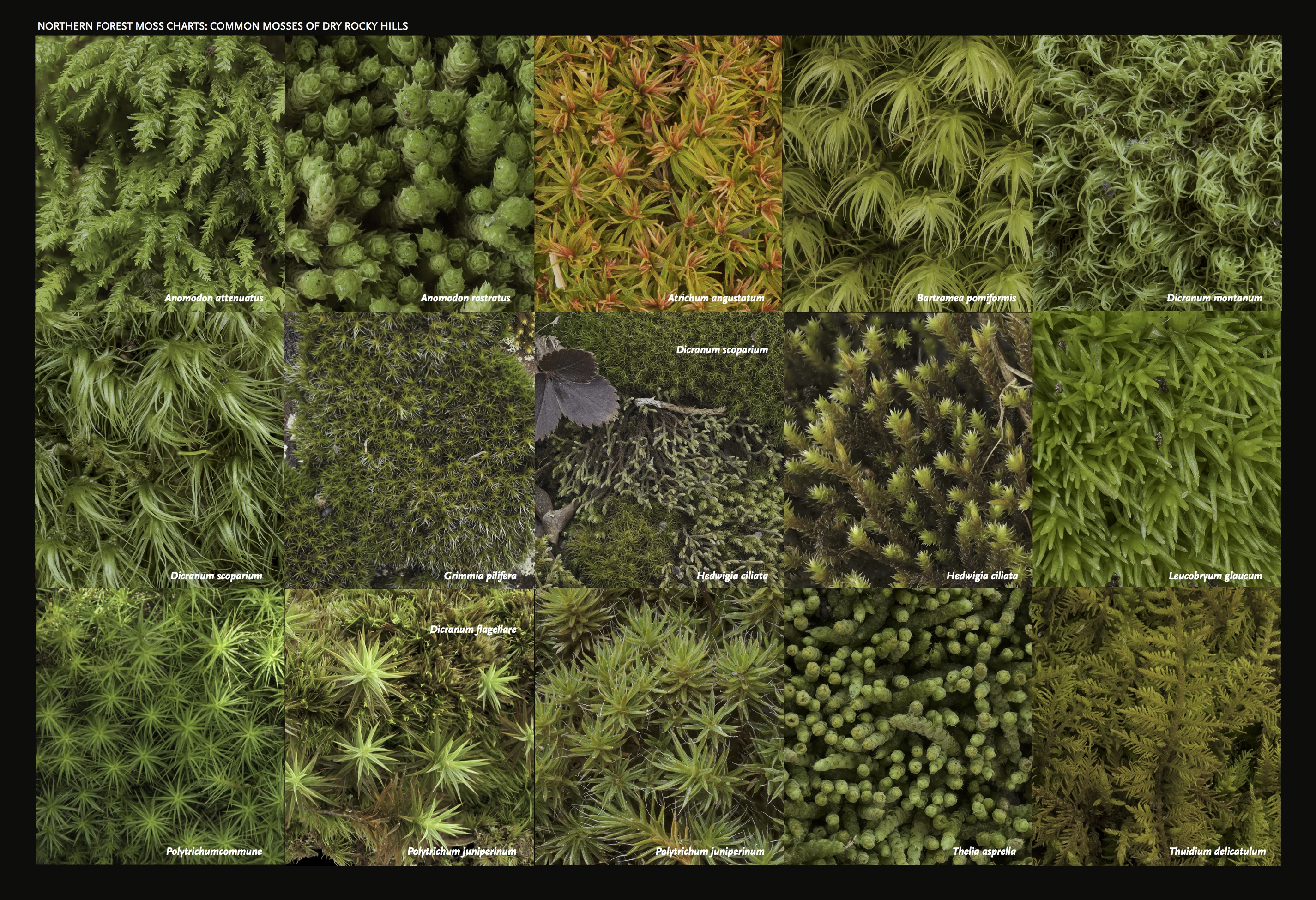
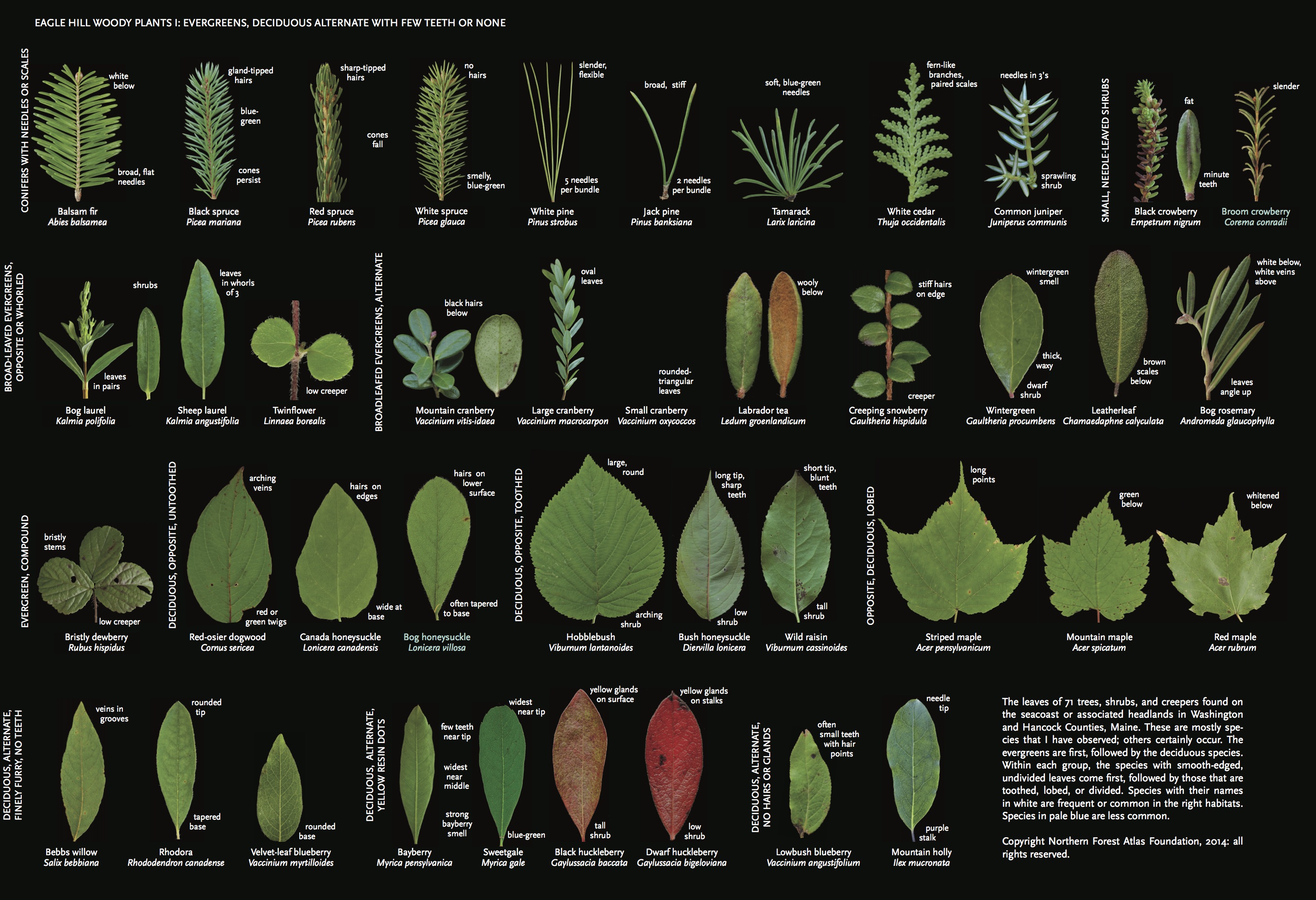
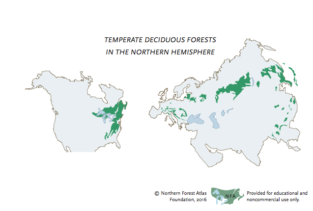
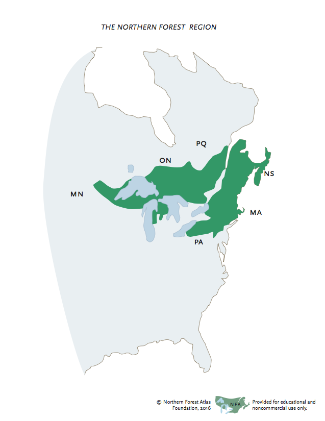
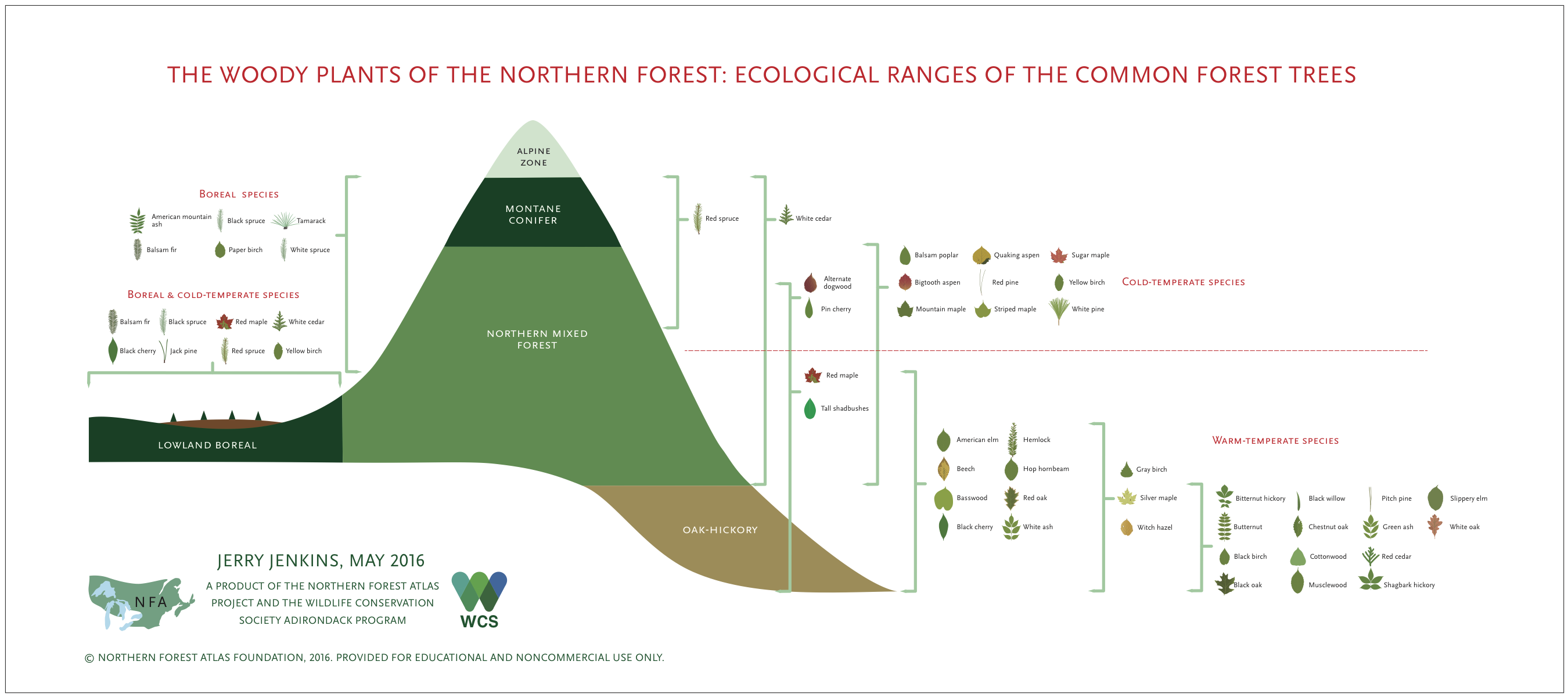
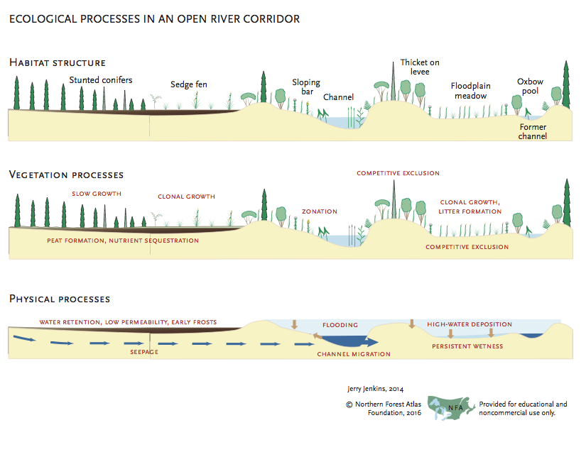
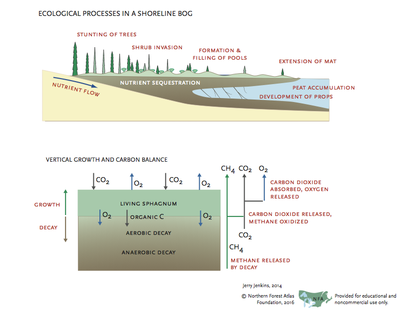
A goal of the Atlas project is to illustrate natural patterns: how species compare to each other, how they are grouped into communities and landscapes, and how the communities and landscapes work. To do this, we create maps, diagrams, drawings, and photomontages. Some are stand-alone products, others are drafts of illustrations to be combined with others or used in books.
To see a larger version of any graphic, click the image or the title and then zoom with control + or command +. To zoom farther (necessary on the large charts!), click the image again to open it in a separate window. To see all the charts of a particular type, click an entry in the index.
The versions shown on this page are medium resolution jpegs or svgs for use on screen. The files, especially for the complex posters are pretty big and may take a while to load. They may be downloaded without permission for educational and non-commercial use.
High-resolution pdf versions for most of these graphics, suitable for printing, are available for download. They are free for educational and noncommercial use.
The Atlas project should be acknowledged for all uses (©Northern Forest Atlas Foundation). Graphics may not be published or posted to other websites without permission. For permission or for commercial use of graphics, please contact us below.
